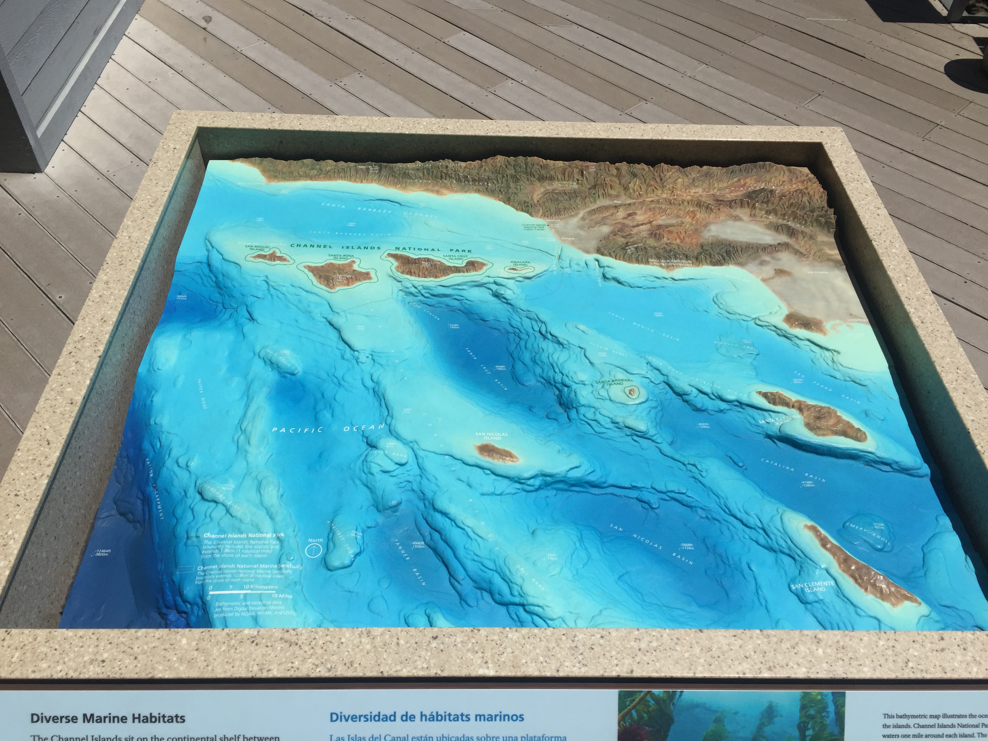
I always love raised relief models and maps—this being a great example at the Channel Islands National Park Visitor Center in Ventura, California.
Personal Notebook
I always love raised relief models and maps—this being a great example at the Channel Islands National Park Visitor Center in Ventura, California.

Stumbled across WebTrak for Santa Monica Airport showing live flight tracking in the Los Angeles area.
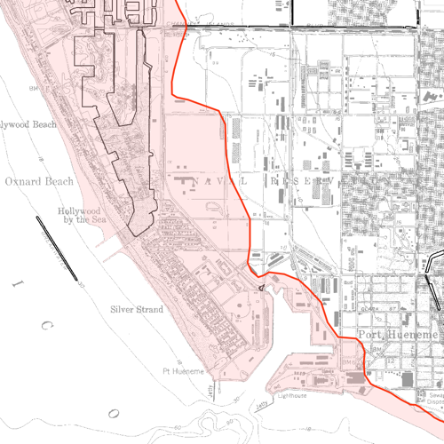
Tsunami Inundation Map centered on Port Hueneme, California. The larger quadrangle maps for Ventura County and other coastal California counties and be found on at the state Department of Conservation site.
Source: State of California, 2009, Tsunami Inundation Map for Emergency Planning, Oxnard Quadrangle, Ventura County; produced by California Emergency Management Agency, California Geological Survey, and University of Southern California – Tsunami Research Center; dated February 15, 2009, mapped at 1:24,000 scale.
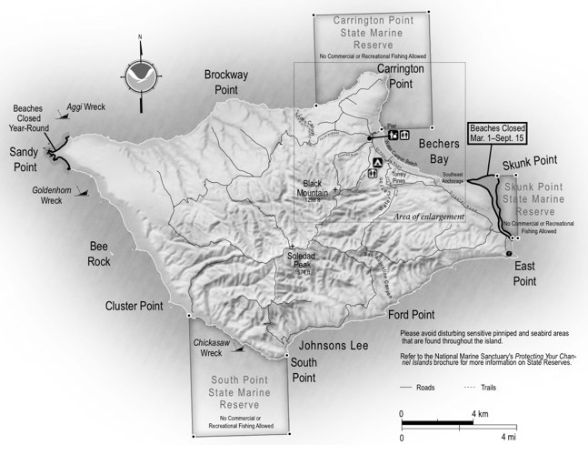
NPS hiking map of Santa Rosa Island (source).
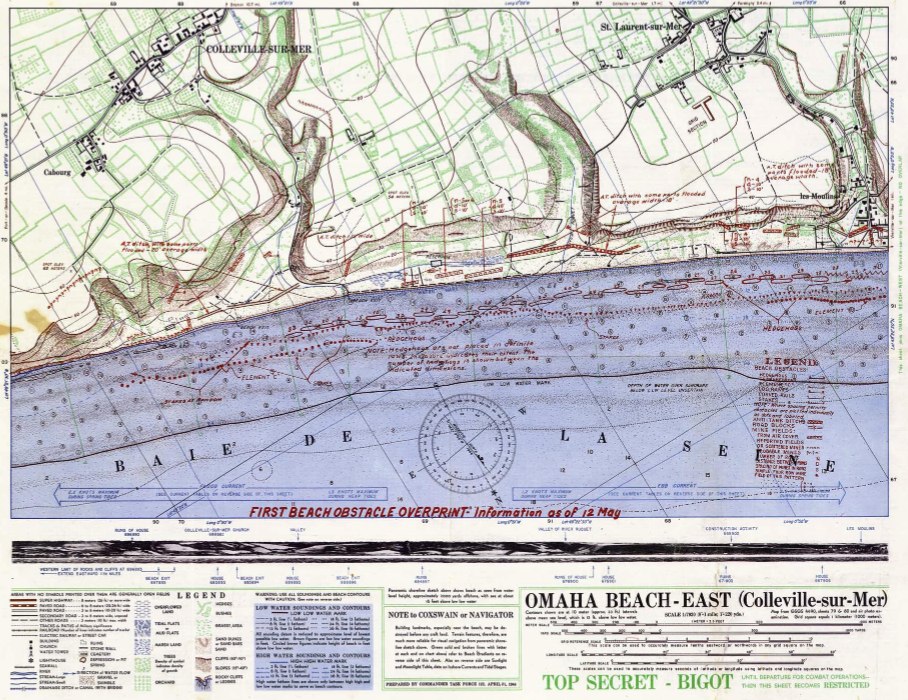
“Top Secret – Bigot” maps from the D-Day invasion available for sale and in high resolution for download. The term “Bigot” denoted a special, compartmentalized clearance for the Normandy operation. Those with this clearance were “bigoted”.
I’m still on the lookout for the Bigot map depicting the overall plan, similar to this one.
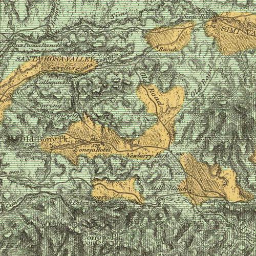
US Geological Survey map of northern Los Angeles and Ventura County from 1881. Thanks to the David Rumsey Collection, you can download this and other maps at very high resolution–makes for endless browsing.
Locals will note the curious reference to Old Bony Peak and Conejo Peak, among the hundreds of interesting observations this map yields. Enjoy!
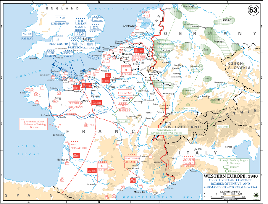
For history buffs, visit this extensive collection of military maps from the US Military Academy which includes 84 items for WWII’s European Theater such as the one above.